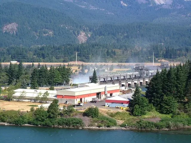
On March 10, 1957, the gates of The Dalles Dam closed, and within about four and a half hours the rising waters of the new reservoir covered Celilo Falls. A place where Native people had fished, traded, and lived for at least 11,000 years — known in the Sahaptin language as Wy-am, “echo of falling water” or “sound of water upon the rocks” — fell silent beneath what is now called Celilo Lake.
The Ancient Falls
Celilo Falls was a horseshoe-shaped cataract where the entire Columbia River squeezed through basalt channels as narrow as 40 feet across. The main falls dropped roughly 20 feet, the most dramatic moment in a half-mile stretch of falls and rapids where, as historian Katrine Barber notes in the Oregon Encyclopedia, the river fell more than 80 feet. During spring floods, far more water thundered over Celilo than passes over Niagara Falls today.
The churning water concentrated migrating salmon into narrow channels, creating one of the most productive fishing sites on the continent. Archaeological records date human occupation of village sites along the falls to at least 11,000 years ago, and Celilo Village, on the river’s south shore, is described by the Oregon Encyclopedia as Oregon’s oldest continuously occupied site. The Columbia River Inter-Tribal Fish Commission calls Wy-am one of the longest-occupied sites in North America.
A Continental Trading Center
Celilo was as much marketplace as fishery. Lewis and Clark described the area as the “great mart” of the region, and the fur trader Alexander Ross, who passed through in 1811, called the narrows trading grounds a great “emporium.” Modern historians have sometimes dubbed it the “Wall Street of the West” for its role as a hub of Indigenous trade.
During the fishing season, up to 5,000 people gathered at the falls, according to the Columbia River Inter-Tribal Fish Commission. Members of the Yakama, Warm Springs, Umatilla, and Nez Perce nations, along with many other groups, came to fish, trade, feast, arrange marriages, hold ceremonies, and settle diplomatic business. Goods moved through Celilo from across the continent — coastal shells, plains hides, and more — making the falls a crossroads of Native North America.
Fishing the Falls
Fishermen worked from wooden platforms and scaffolds cantilevered over the rapids, sweeping long-handled dip nets through the roiling water for salmon, steelhead, lamprey, and sturgeon. It was skilled and dangerous work; men tied safety ropes around their waists, and falls into the river could be fatal.
Fishing stations were not open to all comers. Specific sites belonged to particular families and were passed down through generations — a system of hereditary rights and resource management that sustained the fishery across millennia. The catches were enormous: the Northwest Power and Conservation Council notes that during peak runs, several hundred fish per day per fisher were common.
Treaty Rights and the Dam
In the 1855 treaties negotiated at Walla Walla, the Yakama, Warm Springs, Umatilla, and Nez Perce ceded millions of acres while reserving the right to fish at their “usual and accustomed” places — including Celilo Falls.
A century later, those rights collided with the federal push to develop the Columbia for hydropower and navigation. The Army Corps of Engineers began building The Dalles Dam in 1952. Because the reservoir would flood Celilo Falls and nearby fishing sites at Fivemile and Tenmile rapids — described by the Oregon History Project as some of the most productive salmon fishing sites in all of North America — the federal government negotiated cash settlements with the four treaty tribes rather than halt the project. Many tribal members and leaders opposed the dam; the settlements compensated for the flooded fishery but did not extinguish treaty fishing rights.
March 10, 1957
When the dam’s gates closed, the reservoir backed up quickly. Within hours, the falls and a portion of Celilo Village were under water. Witnesses gathered on the banks; the last First Salmon ceremony at the falls had been held the previous spring, on April 20, 1956.
The settlements, negotiated in the 1950s, totaled about $26.9 million: $15,019,640 to the Yakama Nation, $4,616,971 to the Confederated Tribes of the Umatilla, $4,451,784 to the Confederated Tribes of Warm Springs, and $2,800,000 to the Nez Perce Tribe, according to the Northwest Power and Conservation Council. The Oregon History Project records that enrolled Umatilla and Warm Springs members received roughly $3,700 each. Tribal members have said ever since that no payment could substitute for the falls themselves.
Aftermath
The flooding of Celilo ended a fishery and an economy that had anchored Native life on the mid-Columbia for thousands of years. Families were displaced from homes along the river, longstanding trading and ceremonial gatherings lost their setting, and an entire body of knowledge — about channels, currents, platforms, and fish — lost the place it described. Historians such as Katrine Barber, author of “Death of Celilo Falls,” have documented the inundation as one of the defining losses of twentieth-century Pacific Northwest history, and its memory remains a source of grief and grievance for river tribes today.
The Falls Beneath the Lake
The falls themselves still exist. In 2007, the Army Corps of Engineers mapped the river bottom with multibeam sonar, and the results, released in 2008, showed the main cataract intact beneath the reservoir — disproving persistent rumors that the falls had been dynamited or buried in silt. In 2019, Yakama Nation leaders publicly called for removing The Dalles Dam and the other lower Columbia dams and restoring the falls, a proposal that remains part of the wider debate over salmon recovery on the river.
Celilo Village Today
Celilo Village endures on the bluff above Interstate 84, home to a Native community that continues to fish the Columbia at remaining sites, hold First Salmon ceremonies, and commemorate the falls each March. The dam, for its part, generates hydropower (with a total capacity of about 1.8 million kilowatts, per the Oregon History Project) and opened the river to barge navigation.
Wy-am is gone from sight but not from memory. Its name appears on schools, longhouses, and restoration campaigns across the region, and for the river tribes the echo of falling water remains — a place drowned, remembered, and still contested.