Ancient Prairie Ecosystem (8,000+ Years)
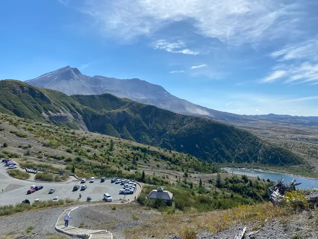
Mashel Prairie represents the easternmost natural prairie in the Nisqually River watershed, formed where the Mashel and Nisqually Rivers converge. This unique 100-acre meadow developed due to poorly drained soil that favored grasses, bulbs, and shrubs over trees, reaching its ecological peak during a warmer period around 8,000 years ago.
The Squally-Absch people (upper Nisqually Indians) stewarded this land for millennia, practicing sophisticated ecosystem management including:
- Seasonal gathering of bracken fern and camas bulbs
- Careful soil cultivation with traditional digging sticks
- Controlled burning to suppress tree growth and maintain open grassland
- Sustainable resource management that preserved the prairie ecosystem
The Mashel Band
The region was home to a distinct band of upper Nisqually Indians known as the Mashel Band. These indigenous residents maintained strong familial ties with Sahaptin-speaking peoples on the eastern slopes of the Cascade Mountains, enabling them to successfully incorporate horses into their traditional lifestyle as these animals became available in the Pacific Northwest.
The Mashel Massacre (late March 1856)
During the Puget Sound War (1855-1856), Mashel Prairie became the site of one of the most tragic episodes in Washington Territory’s history. Captain Hamilton J.G. Maxon led Washington Territorial Volunteers in an attack on a band of Indigenous families camped near the confluence of the Mashel and Nisqually Rivers.
The Attack
Official reports claimed only eight “hostiles” were killed, but virtually all historical accounts agree that Maxon’s Raiders massacred defenseless elderly people, women, children, and infants who were fleeing the broader conflict. This became known as the Mashel Massacre, serving as the final episode of the Puget Sound Indian War.
Historical Cover-Up
The incident was deliberately obscured from many early regional histories, reflecting the territorial government’s desire to downplay civilian casualties. The massacre remains controversial. According to some later accounts, soldiers reportedly justified the killing of children with the phrase “nits make lice,” though historians question this claim, as the quote is most famously tied to the 1864 Sand Creek Massacre and its attribution here is considered unreliable.
Indian Henry (Soo-Too-Lick): Bridge Between Worlds (1864-1895)
Early Life and Heritage
Born around 1825, Soo-Too-Lick had roots among the Klickitat and Yakama Nations of eastern Washington. He became widely known as “Indian Henry,” a nickname commonly attributed to a mail carrier, Henry Winsor, who found his given name difficult to pronounce; the often-repeated translation of his name as “Goes to the Mountains” is unverified. Around 1864, he settled on Mashel Prairie among other Native Americans, primarily of Nisqually and Klickitat descent, rising to a leadership position in the community.
Cultural Adaptation and Success
Indian Henry became a remarkable example of successful cultural bridging:
- Farming Enterprise: Raised horses, cattle, grain, and vegetables on a highly productive homestead
- Mount Rainier Guide: Led expeditions for James Longmire, John Muir, and other notable explorers
- Multilingual Communication: Spoke several languages, facilitating cross-cultural dialogue
- Christian Conversion: Adapted to changing religious landscape while maintaining cultural identity
- Family Life: Initially had three wives by traditional custom, later reduced to one by legal requirement
Legacy and Recognition
- Indian Henry’s Hunting Ground: Popular hiking area in Mount Rainier National Park named in his honor
- Satulick Mountain: Named as a variation of his indigenous name So-To-Lick
- Historic Trails: His routes became the foundation for highways over Mount Rainier and White Pass
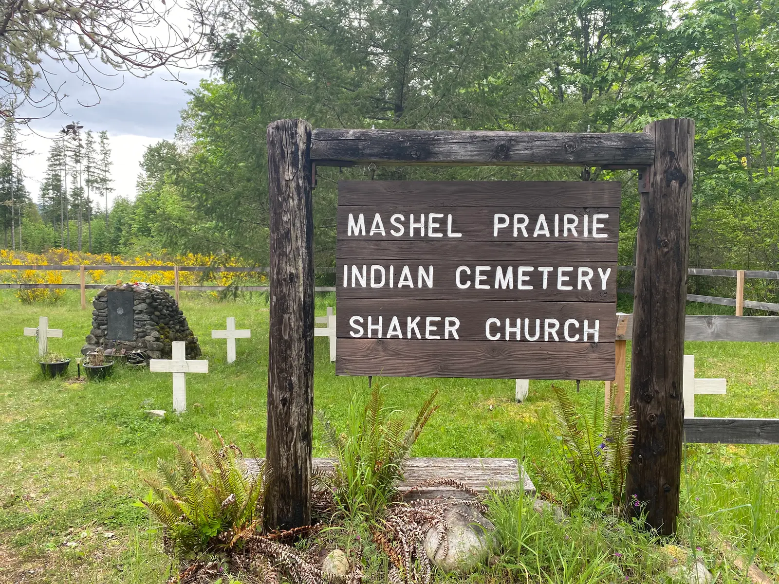
After Indian Henry’s death in 1895, several family members remained on Mashel Prairie, building a Shaker Church in 1913 near his gravesite. This religious community blended Christian and indigenous spiritual traditions, creating a unique cultural synthesis that continued into the 20th century.
Mashel Prairie Indian Cemetery
The Mashel Prairie Indian Cemetery contains approximately 20 graves and serves as the final resting place for Indian Henry and other community members. The cemetery features:
- Indian Henry’s monument, originally built by a local 4-H Club and restored by Eagle Scouts in 2005
- Historic Shaker Church building (now converted to private residence)
- Small, fenced cemetery area with limited public parking
- Brown state landmark sign marking the site
Modern Recognition and Access
Today, Mashel Prairie is being developed as part of Nisqually State Park, with interpretation focusing on the story of the Squally-Absch people through time. The Mashel Prairie Trail offers a 2.5-mile hiking experience through this historically significant landscape.
- Location: Mashel Prairie Road East, Eatonville, WA
- Access: From I-5 exit 127 → Highway 512 east → Pacific Ave/Mt. Rainier exit south → Highway 7 south for 17 miles → Turn right on Mashel Prairie Road East
- Features: Cemetery, trail access, historical interpretive opportunities
- Management: Part of developing Nisqually State Park system
Cultural and Historical Significance
Mashel Prairie represents multiple layers of Pacific Northwest history:
- Indigenous Stewardship: Thousands of years of sustainable ecosystem management
- Territorial Conflict: The devastating impact of the Puget Sound War on Native communities
- Cultural Bridge-Building: Indian Henry’s remarkable adaptation and leadership
- Religious Synthesis: The unique Shaker Church community blending traditions
- Conservation Legacy: Modern efforts to preserve and interpret this complex history
This landscape tells the story of both profound loss and remarkable resilience, honoring the indigenous peoples who shaped this land while acknowledging the tragic conflicts that marked Washington Territory’s early years.