The mountain gave fair warning. For two months before May 18, 1980, it shook with small earthquakes and vented steam from a growing bulge on its north flank. Scientists set up observation posts. Roads were closed. Most people left.
Harry Truman did not leave. The 83-year-old innkeeper had run Mount St. Helens Lodge at the foot of the mountain for fifty years and refused every evacuation order. “The mountain’s part of Truman and Truman’s part of that mountain,” he told reporters. On May 18, a wall of debris buried him and his lodge under 150 feet of rock and ash. His body was never recovered.
At 8:32 a.m., a magnitude 5.1 earthquake destabilized the north flank. What followed was not a conventional eruption. The entire bulging face of the mountain collapsed at once, releasing pressure that had been building for weeks. The result was a lateral blast, a horizontal explosion moving northward at speeds between 300 and 670 miles per hour. In the next few minutes, that blast incinerated and flattened 230 square miles of old-growth forest. Trees 60 feet tall snapped like pencils, their trunks pointing away from the mountain in concentric arcs that are still visible from the air today.
Volcanologist David Johnston was monitoring the eruption from an observation post on Coldwater Ridge, about six miles from the summit. He had time to radio one message: “Vancouver! Vancouver! This is it!” Johnston and his post were obliterated within seconds. He was 30 years old.
The eruption column rose 15 miles into the stratosphere in under 15 minutes. Ash fell across eleven states and was measurable as far away as Oklahoma. The sound of the blast was heard in Montana, 1,200 miles north. The Toutle River was buried under a debris avalanche up to 600 feet deep. Lahars, rivers of volcanic mud moving at 50 miles per hour, scoured river valleys for 50 miles in every direction. Spirit Lake was choked with logs and debris and raised 200 feet in elevation. The entire north face of the mountain was gone. Where a symmetrical 9,677-foot peak had stood, there was now a horseshoe-shaped crater open to the north, the summit reduced to 8,365 feet.
Fifty-seven people died. The eruption released energy equivalent to 1,600 Hiroshima atomic bombs.
What happened next surprised everyone.
Scientists expected the blast zone to remain sterile for decades. Instead, life came back almost immediately, and from unexpected directions. Pocket gophers had survived underground, and as they burrowed through the ash layer they mixed it with the older soil below, creating islands where seeds could take hold. Wind carried in spiders and insects. Prairie lupine, a nitrogen-fixing plant, established itself in the bare ash fields within two years and began the slow work of rebuilding soil chemistry.
The recovery has become one of the most closely studied ecological events in history. Rather than managing the recovery, scientists deliberately left much of the blast zone alone, and what they observed overturned assumptions about ecological succession. Life did not return in orderly waves. It returned in patches, in random clusters wherever some scrap of surviving organic material gave it a foothold, and it spread outward from there. The result is a mosaic landscape, pockets of dense recovery next to areas that still look nearly barren, elk herds grazing on meadows that were ash fields twenty years ago, salmon pushing back up rivers that were buried under mud.
From 2004 to 2008, the volcano erupted again in a quieter mode, extruding lava that built a new dome inside the crater. Monitoring equipment now tracks the mountain continuously. Mount St. Helens is classified as active and is considered one of the most likely volcanoes in the contiguous United States to erupt again.
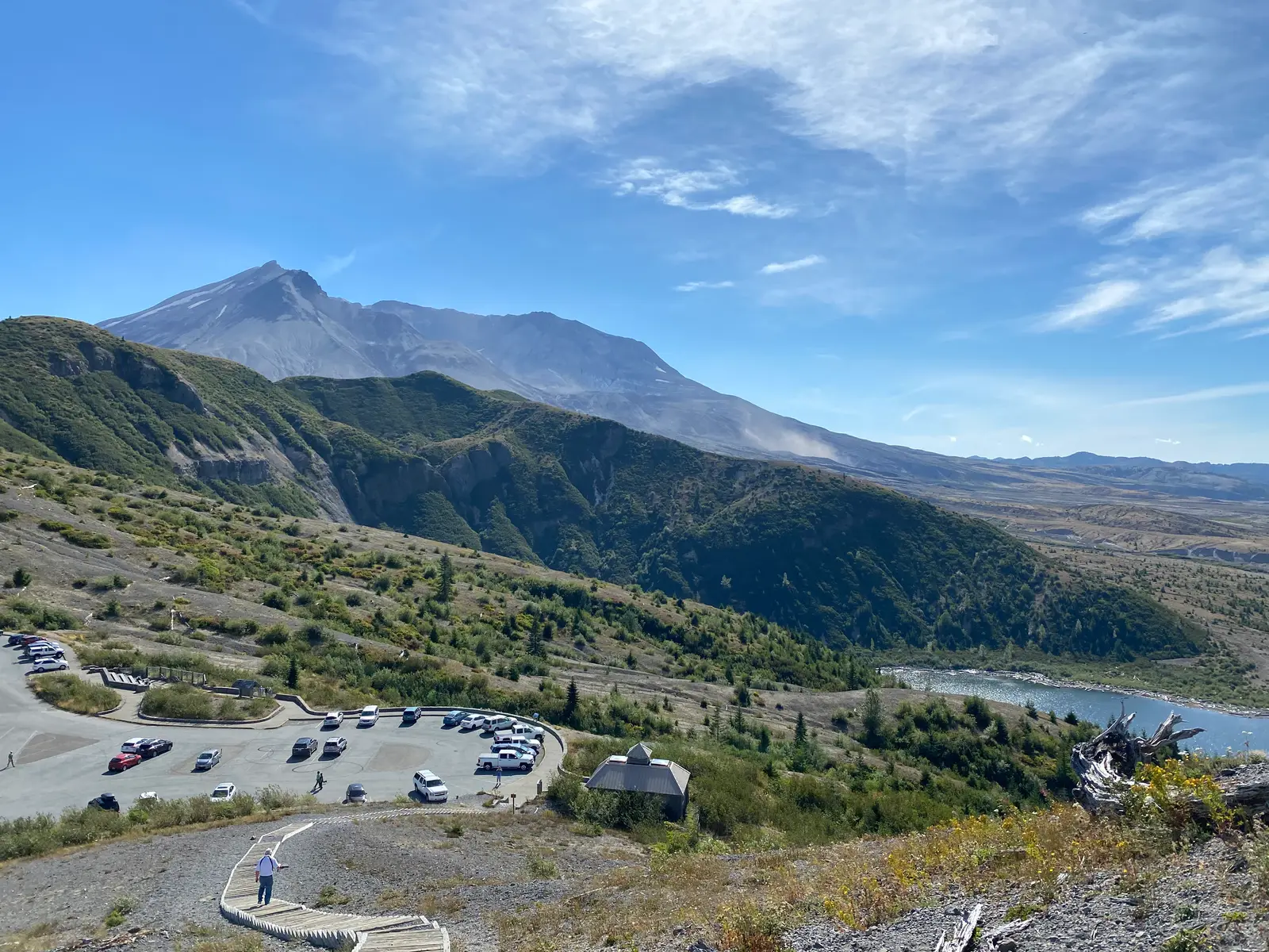
The Johnston Ridge Observatory, built near the spot where David Johnston died, offers the most direct view into the crater. Standing there, you’re looking at the raw interior of a volcano, the lava dome, the steep amphitheater walls, and the debris plain below. The ghost forest of bleached standing logs is visible on the ridgelines. And on the slopes closer to the observatory, if you look carefully, you’ll see the lupine fields and the first scattered trees pushing through the ash, exactly where scientists said nothing should be growing yet.